
M.A. thesis · 2026
Sparse Controls in Spatial Epidemiology
Sparse Control Selection for Spatial Epidemiological Data: Double LASSO and County COVID-19 Mortality
An M.A. thesis on high-dimensional confounding, unstable county mortality rates, and residual spatial dependence.
The problem
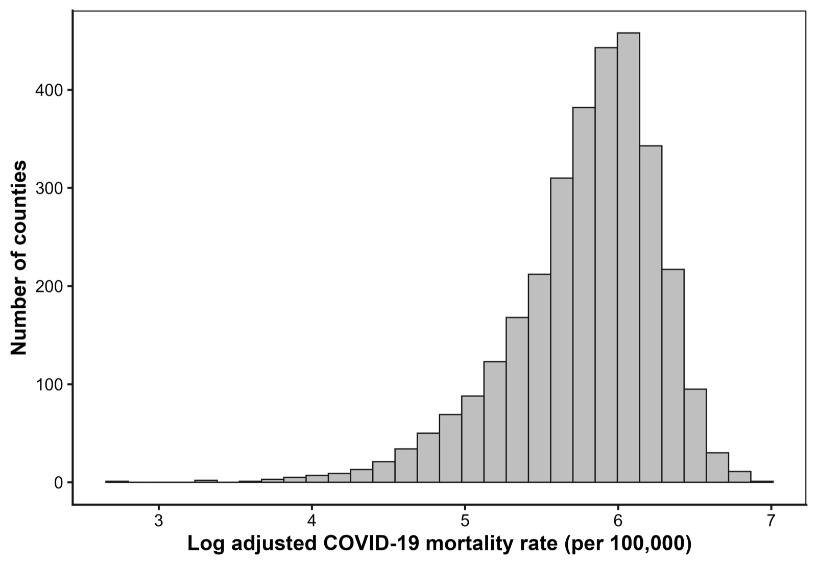
County-level epidemiological studies often begin with many plausible social, demographic, and health-system controls. Including all of them can make estimates unstable; choosing them informally can omit important confounding structure. Rare-event rates can also be volatile in small populations, while neighboring counties can share regional conditions and disease dynamics.
My Statistics & Data Science thesis studies those problems using cumulative COVID-19 deaths through May 2022, 127 candidate county characteristics, and approximately 3,096 counties. Its focal question is whether county-level political ideology—proxied by Republican vote share—remains associated with mortality after demanding adjustment. The design is explicitly ecological and does not support individual-level causal claims.
Descriptive patterns
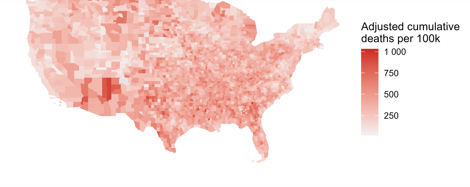
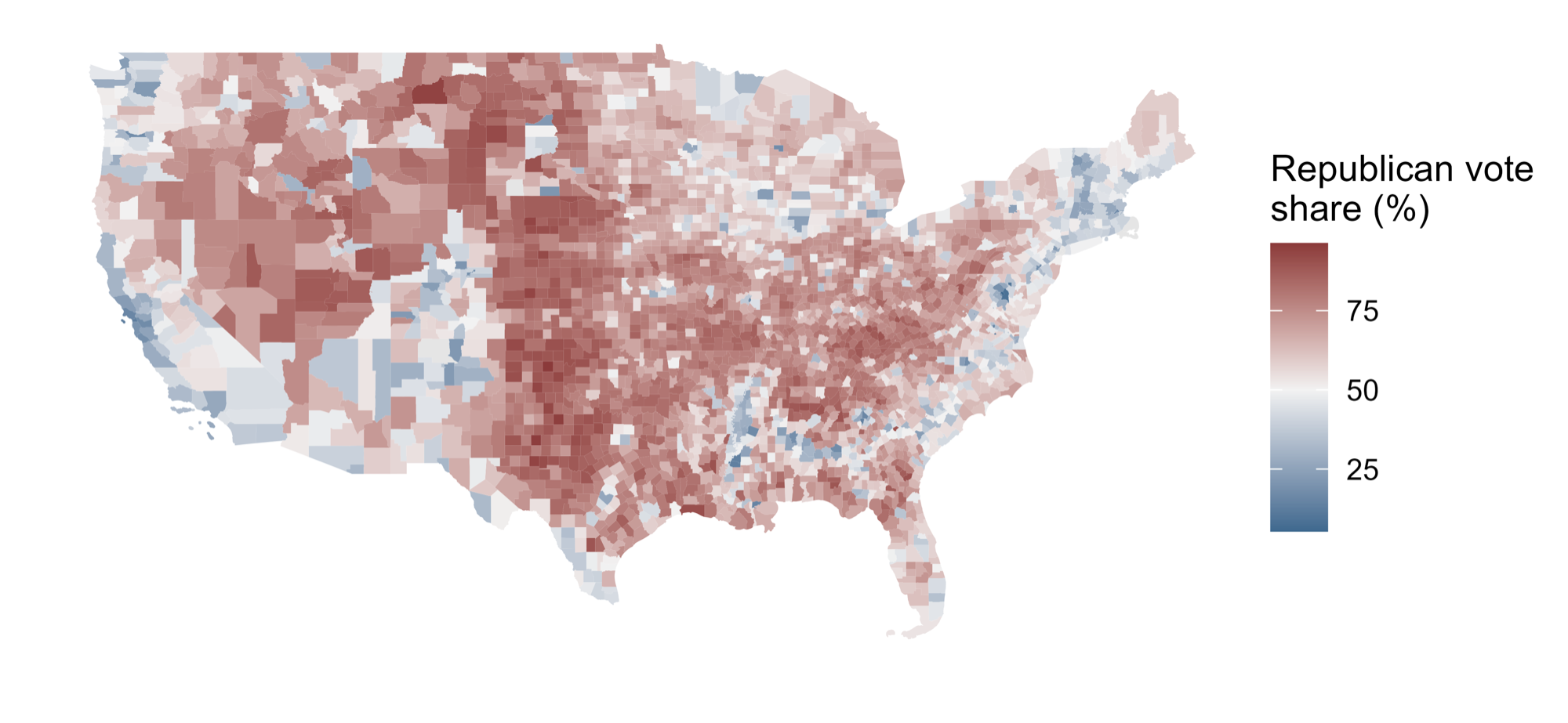
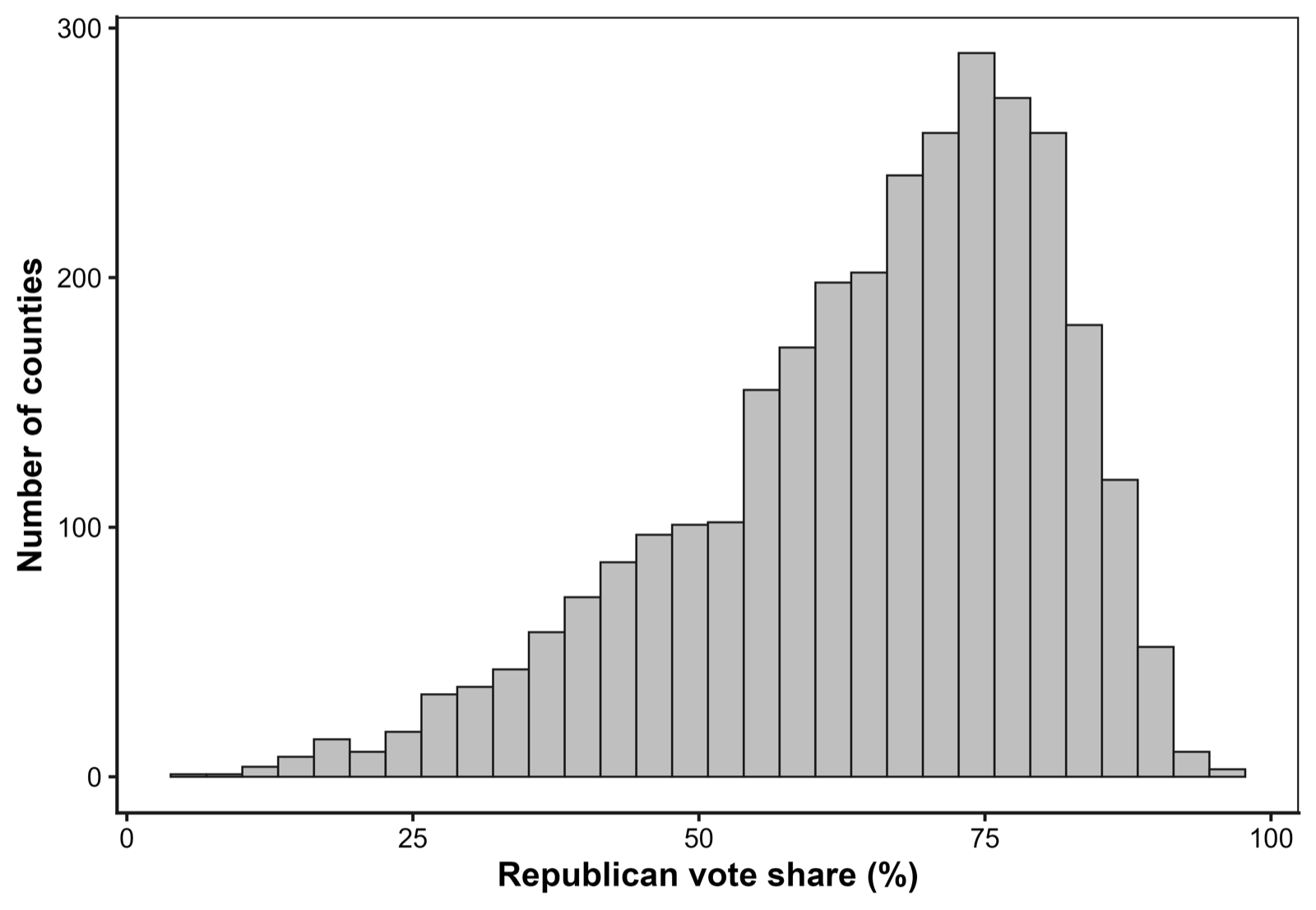
The raw county data already show why a spatial model is necessary. Both the outcome and focal exposure cluster geographically, with neighboring counties often taking similar values. These figures describe the analytic sample before the high-dimensional and spatial adjustments discussed below; they do not establish a causal relationship.
Method
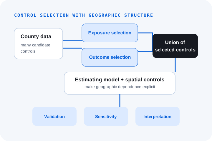
Post-double-selection LASSO uses two related selection steps: one identifies variables associated with the exposure of interest, and the other identifies variables associated with the outcome. The union of those controls is then carried into the estimating model, protecting against variables that predict either side of the relationship. The thesis selects a 48-feature union spanning demographics, vaccination, comorbidities, socioeconomic conditions, healthcare capacity, employment, and geography.
The final stage models death counts directly with a negative-binomial generalized additive model, a population offset, state fixed effects, and a Markov random field smooth based on county adjacency. This combines count-based inference with partial pooling among neighboring counties. Simulation-based residual checks assess dispersion and outliers, and Moran’s I evaluates whether spatial dependence remains after adjustment.
Findings
In the preferred model, a ten-percentage-point increase in county Republican vote share is associated with approximately 13% higher expected COVID-19 mortality, conditional on the selected controls, state effects, and spatial smooth. The non-spatial specification leaves pronounced residual autocorrelation; after adding the adjacency-based term, the residual Moran test is no longer statistically significant. Simulation-based checks likewise find no evidence of remaining over- or under-dispersion or excess outliers.
That result is a robust county-level association, not an estimate of the causal effect of individual political identity. Republican vote share is an ecological proxy for correlated policies, behaviors, institutions, information environments, and demographic conditions, including factors that the available controls may not fully capture.
Limitations and contribution
The cumulative outcome compresses differences across pandemic waves, unobserved confounding remains possible, and the spatial smooth captures residual geography without identifying its mechanism. The hybrid workflow also uses post-double-selection as a principled screening device before a negative-binomial spatial model; it should not be read as an exact semiparametric identification result.
The contribution is therefore both substantive and methodological: the association survives a much richer adjustment strategy, while the analysis demonstrates why reproducible control selection, count-aware modeling, and explicit spatial diagnostics belong together in ecological health research. This case study is a concise overview; the full M.A. thesis is available as a PDF.